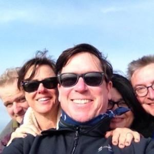
Saunter
Hikes is Rocky Scramble’s newest page. This is where we share the outcomes from the simple act of lacing up hiking shoes. Following are the words of two writers who shared their thoughts on hiking. And below their thoughts, are ours.
As you sit on the hillside, or lie prone under the trees of the forest, or sprawl wet-legged by a mountain stream, the great door, that does not look like a door, opens. ~Stephen Graham, The Gentle Art of Tramping
I remember a hundred lovely lakes, and recall the fragrant breath of pine and fir and cedar and poplar trees. The trail has strung upon it, as upon a thread of silk, opalescent dawns and saffron sunsets. It has given me blessed release from care and worry and the troubled thinking of our modern day. It has been a return to the primitive and the peaceful. Whenever the pressure of our complex city life thins my blood and benumbs my brain, I seek relief in the trail; and when I hear the coyote wailing to the yellow dawn, my cares fall from me — I am happy. ~Hamlin Garland, McClure’s, February 1899
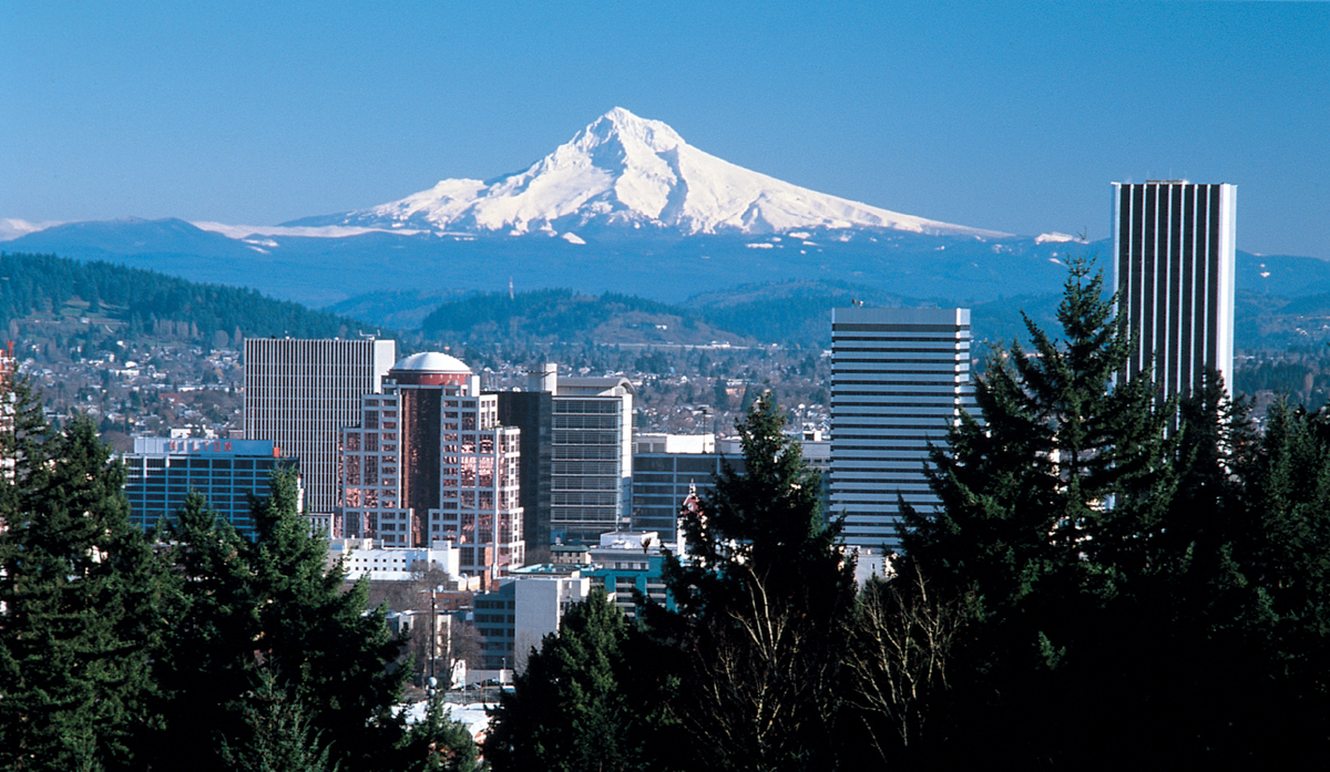
Portland City Hikes (#3) – Sauvie Island
October 18 and November 1
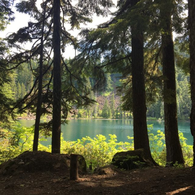
Andy and I hiked the Sauvie Island Warrior Rock Lighthouse trail on bright autumn day in mid-October. And later, on November 1, I returned to hike around Virginia Lake.
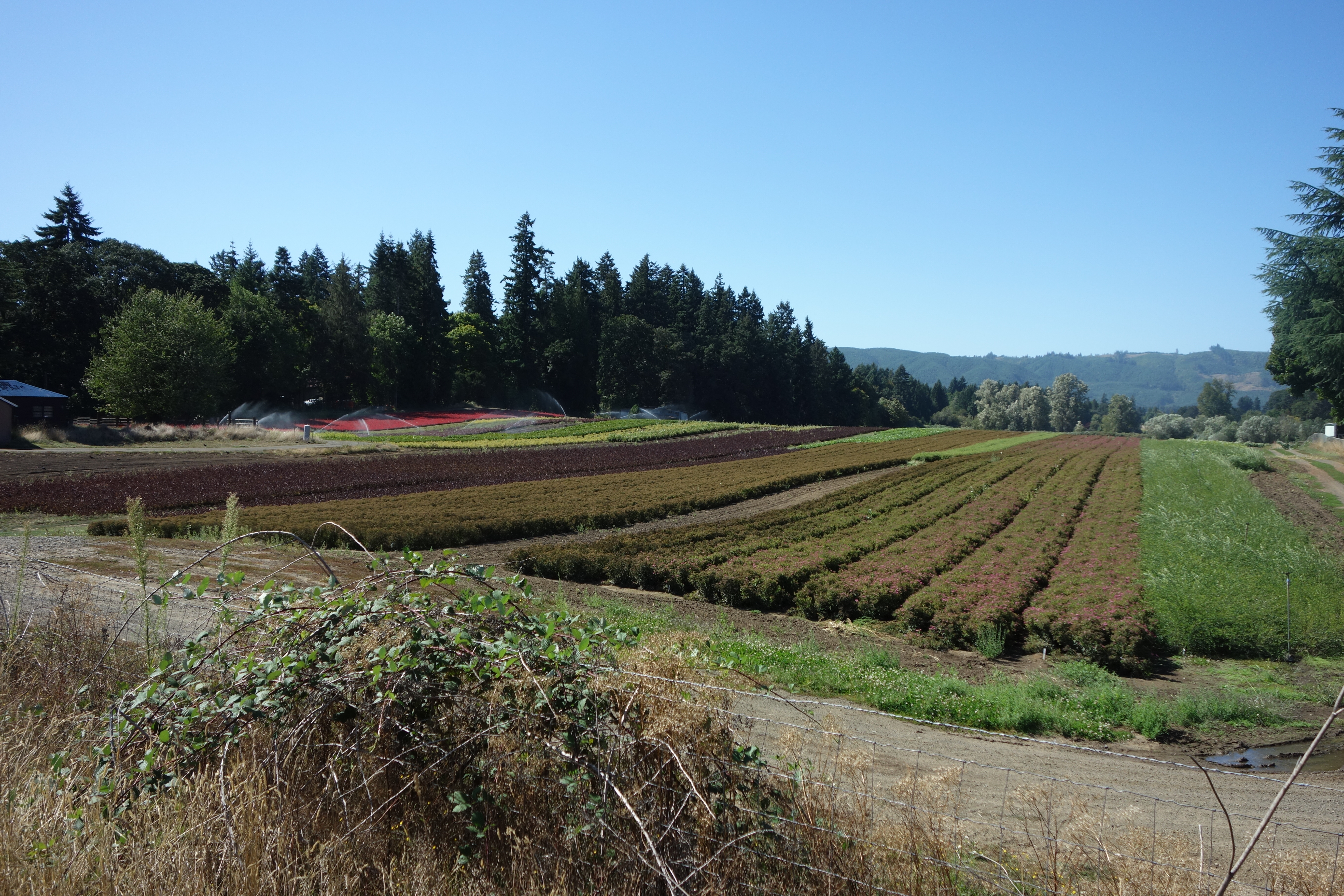
Sauvie Island is a special Portland destination and it sits just 10 miles northwest of downtown. It is the largest island in the Columbia River (32 square miles) and is home to approximately 1,500 nice gentlemen and lady farmers and some ne’er-do- well houseboat dwellers. A large portion of the island is a protected wildlife area.
The Lewis and Clark expedition originally named the island Wapato after the plants that grew there in profusion. Wapato is also known as “Indian Potato” and it was a food source for the 2,000 Native Americans who were the island’s original settlers. But you know the story, by early 19th century trappers and white settlers brought beads, weird religions, and population-devastating disease to the natives.
Historians recorded that most Wapato Island natives were wiped out by the “ague” epidemic of 1829. And by the early 1830’s the native population was so decimated Hudson Bay Company burned the native lodges and removed the remaining survivors. That last sentence encapsulates how I was taught history –annihilation stories told in single sentences with a soft casualness. Words like ‘removal’ and ‘burning’ were used as if they were synonyms for ‘meet’ and ‘greet’.
In the 21st century Portlanders bring their children to Sauvie to walk through corn mazes, pick berries and pumpkins, and get a feel for rural life. Besides a good variety of kid activities in the summer and fall the island also offers outstanding bird watching year-round.
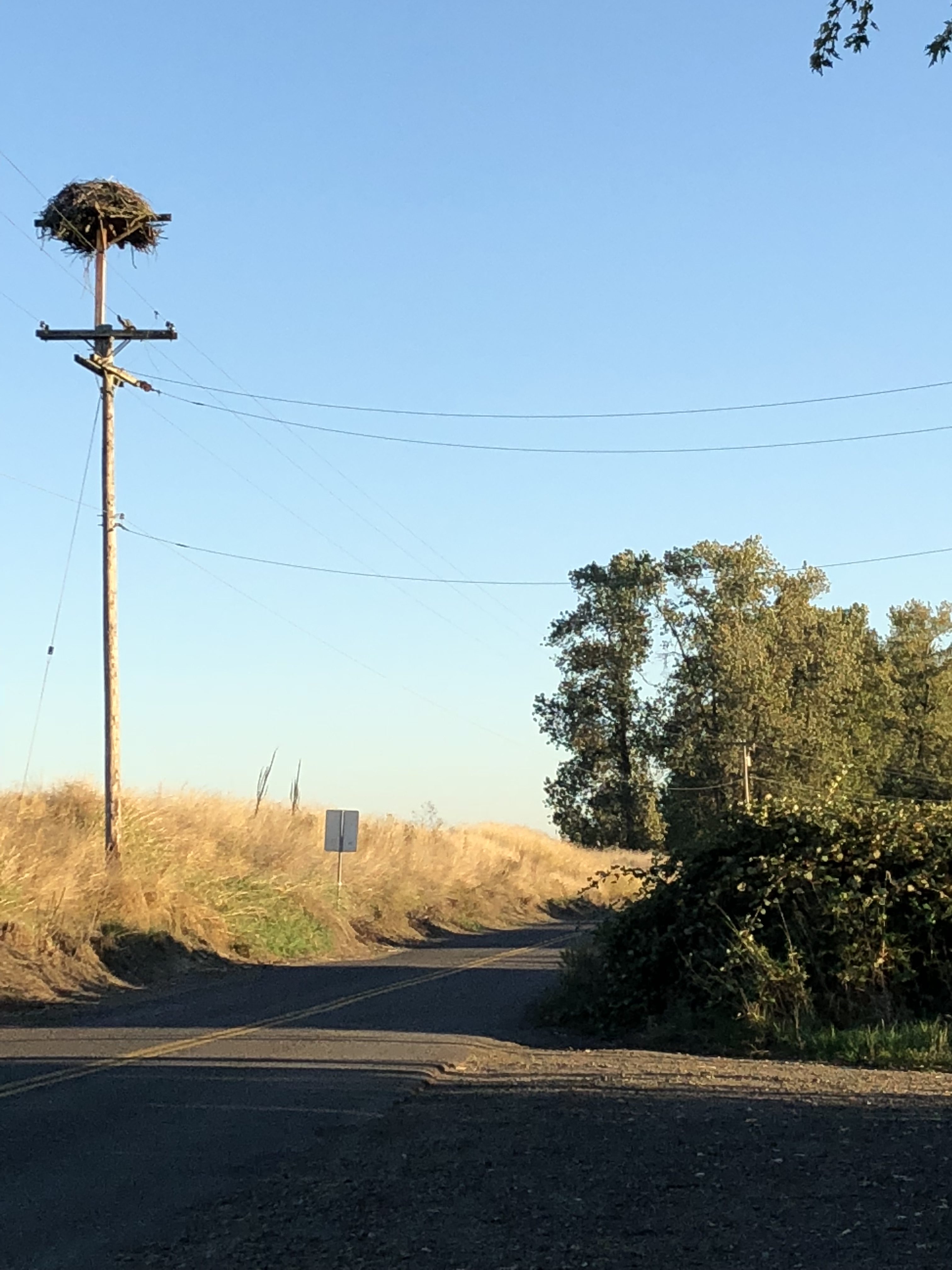
The Audubon Society of Portland website informs there are 500+ bird species in Oregon and 250 of those use Sauvie Island for one thing or another. In fall migrating Sandhill cranes, Snow geese, Tundra swans, and Osprey all nest on the island. On our hike Andy and I saw multiple Osprey nests within feet of one another. Bald eagles breed and celebrate the winter holidays on Sauvie along with other big birds like Northern Harriers and those randy Rough-legged Hawks. Waterfowl on the island exceed 200,000 in the winter.
At first glance Sauvie Island looks Midwestern-agrarian but views open up to 3 close-by mountain peaks (Hood, Adams, and St. Helens) and stands of native evergreen trees punctuate the island. There is a sense of familiarity to the place. Sauvie could well be the source of that pastoral print ripped from a free calendar handed out by an insurance agent your grandma tacked up somewhere in her old craftsman.
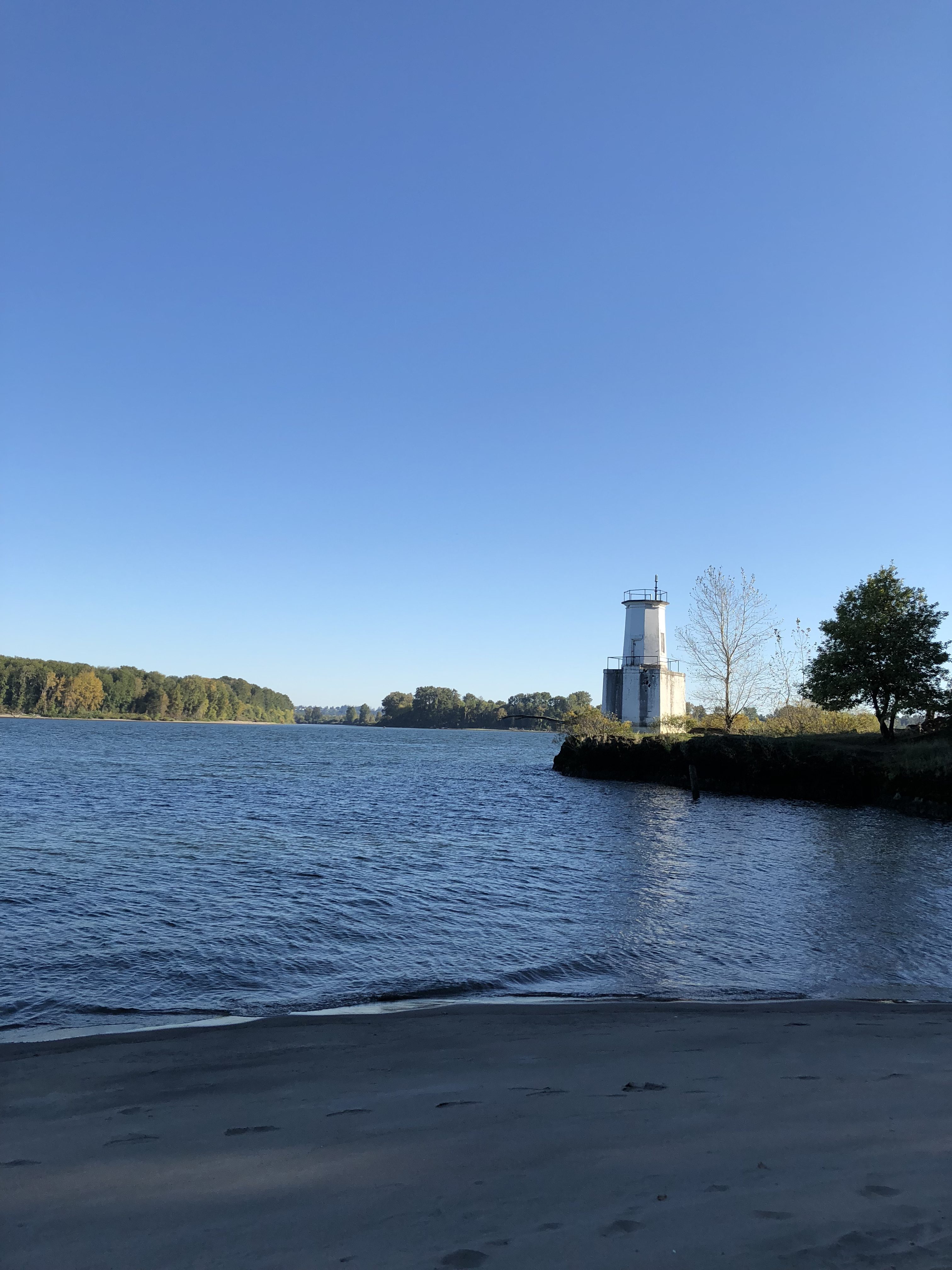
Our hike to the Warrior Rock Lighthouse was over a wide flat trail that is good for running, and multiple runners zipped past us that sunny afternoon. The trail follows one channel of the Columbia River and along our hike we were treated to views of blue water, white sail boats, and deep sandy beaches – sections of which are designated as clothing optional. (Google images of ‘Collins Beach, Sauvie Island’ and you’ll get an eyeful of naked Oregonians.)
After 3.5 miles the trail ends at a point marked by the Warrior Rock Lighthouse. Warrior Rock is Oregon’s smallest lighthouse and only one of two not on the Pacific Ocean. The lighthouse is automated and sounds a bell and shines a beacon for boats and ships to be wary of the Sauvie Island reef.
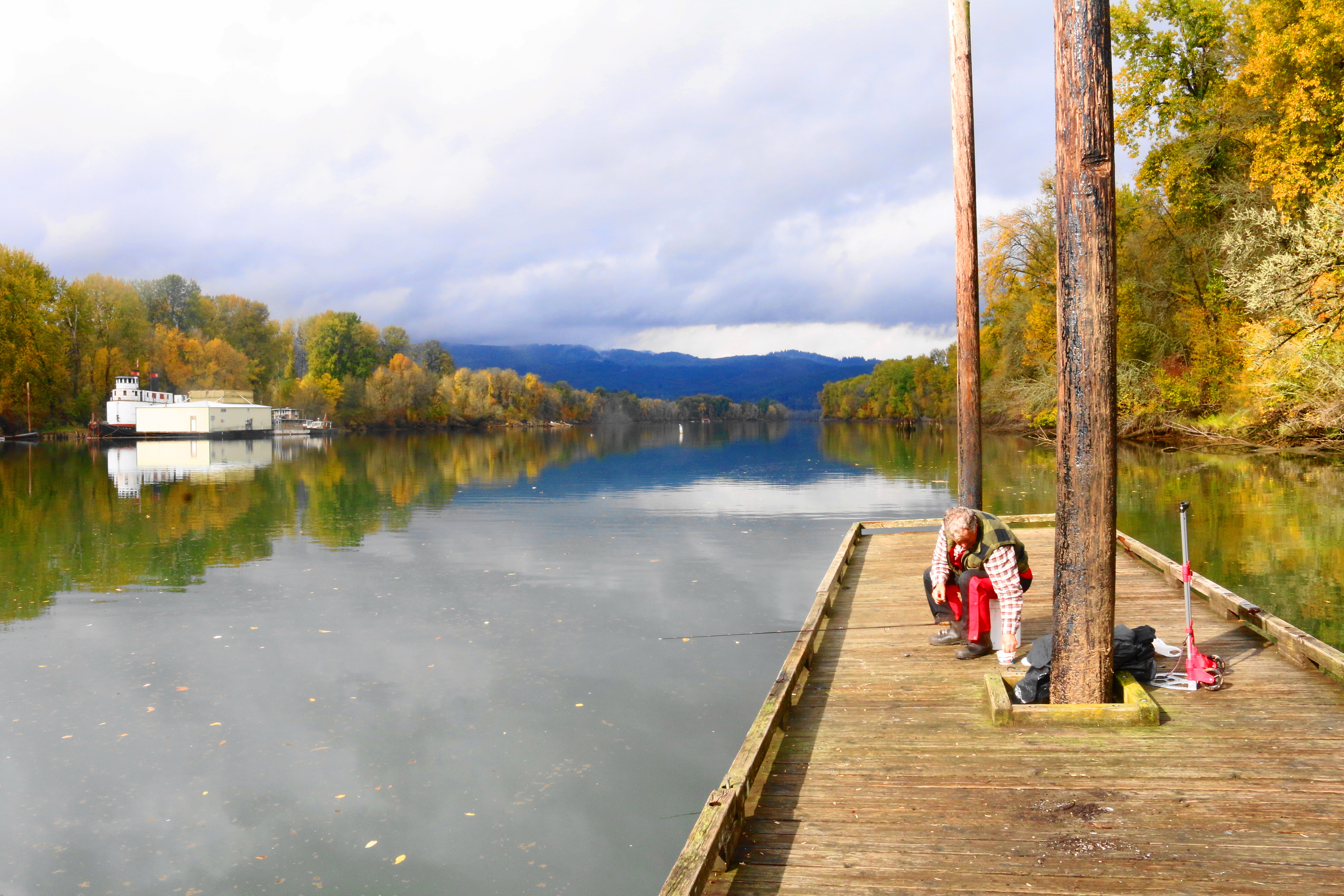
The second time back to Sauvie I walked another wide flat trail around Virginia Lake. I found the hike on a web site but when I returned home Andy checked to find the trail and Virginia lake on a map and couldn’t find either. In fact, we couldn’t find a reference to the lake on any official map of Sauvie. So, the whole trek has a tinge of the surreal to it.
To add to the strangeness of the day, at the turn-around point for the Virginia Lake trail I found a dock where no one spoke English nor did they acknowledge me -they didn’t lower their eyes or look away as I passed, they acted quite simply as if I was not there, as if I was unseeable. Side note: it was Day of the Dead when I took this hike. Draw your own conclusions but I plan on returning soon to figure out that “lake”.
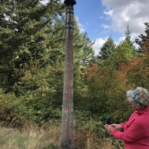
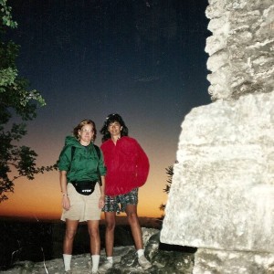
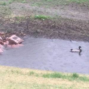
Both trails were comfortable out and back trails. And those two trails (uhm…if there really was a Virginia Lake trail) are just two among a good number on this bucolic island, just northwest of dense and bustling Portland. We’ll come here when you visit if you would like. The options are endless for a good day of outdoor activity: flat hiking trails, naked swimming, berry picking, kayaking, bike riding, bird watching, and maybe even a tibble if its between October and April (see the final pictue).
Portland City Hikes (#2) – Mt. Tabor Park
September 29 and October 3
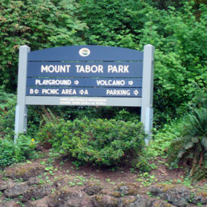
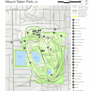
Mt. Tabor Park is the crown jewel of a southeast Portland neighborhood of the same name. The park wears an exuberant carpet of green that runs under tall firs and traverses alongside gravel paths. Tabor stretches for 190 acres and is crisscrossed by multiple hiking, biking and walking trails. It also reaches into the sky; at 650 feet above the Willamette Valley floor you can catch glimpses of the park from lucky parts of the city. The park’s most unique characteristic is that it is built on an extinct volcanic cinder cone.
Recently, I have hiked through this city park twice, the first time with Andy on a Saturday morning and then again a few days later with my friend, Lori.
More cool things about this park: the cone is part of the Boring Lava field – which is a network of cinder cones and small shield volcanoes that run from Boring, Oregon to southwestern Washington. Three other cinder cones of the Boring Lava field sit within Portland city limits.
–>Boring, Oregon is a sister city to Dull, Scotland. Boring and Dull couldn’t milk that partnership enough so they created The League of Extraordinary Communities and invited Bland, New South Wales, Australia to join their exclusive club.
On Mount Tabor there are 3 beautiful open-air water reservoirs and gatehouses, all were built at the turn of the 20th century to supply drinking water to some east Portland neighborhoods. The reservoirs are no longer used for water supply but have been placed on the National Register of Historic Places and must be maintained. In 2011, a man was seen peeing into one of the reservoirs and the resulting citizen uproar led to a decision to drain that reservoir’s water, costing about $36,000 to do so. There have been other grumblings of money mismanagement regarding the reservoirs but that story is one of the juiciest.
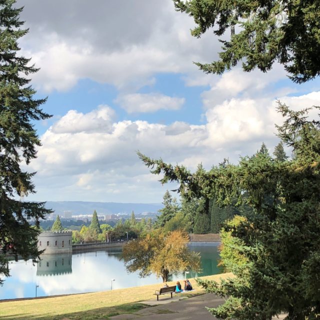
I checked with my friend Janet, who is a water scientist for Portland, to confirm that what I had discovered about the reservoirs and the peeing incident was correct. “True,” Janet confirmed, but she also shared that the continued maintenance of the reservoirs is not assured. It’s expensive and just because people in the Mt.Tabor neighborhood like the reflecting pools they’ve walked around for years doesn’t mean that the Parks Department is willing to support this indulgence forever. In anticipation of the eventual shut-down requests have gone out on what do with the reservoirs. Many proposed designs have been eccentric and over-the-top (to be expected?) but one that captured Janet’s imagination: pipe the hot mineral water that may be flowing beneath the lava field into the reservoirs and create public hot springs. I love this idea, Portland as Reykjavík South.
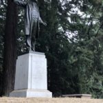
Mount Tabor Park also has a well outfitted playground, an outdoor amphitheater, basketball and tennis courts, softball fields, and the requisite statute of an old dead white guy, Harvey Scott who was a local newspaper editor. Lori shared this bit of wisdom as we walked up to the statue during our hike, if we moved Harvey off his pedestal and looked at him straight on, his head would look as if he was suffering from hydrocephalus, which by the way no one suffers from any more, because of shunts (Lori knows this stuff, she is a nurse). Lori clarified, sculptors create them with very big heads and put them on pedestals so as we gaze up in awe, the perspective looks right. A side note, Harvey Scott’s likeness, including his boulder-sized head, was created by Gutzon Borglum while he was at work on the Mt. Rushmore presidents.
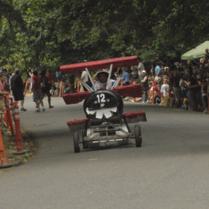
Mount Tabor Park is home to an annual Adult Soapbox Derby. Every year home-made cars, some of which go as fast as 50 miles per hour, race down the cinder cone. This year over 40 people registered for the race which is seven-tenths of a mile. I have seen the videos. Race Day looks to be my kind of fun with its hints of cartoonish danger, clever car designs, and costumed drivers who are urged on from the sidelines by their slightly inebriated but enthusiastic buddies. This is not a sanctioned city park event, but has grown in popularity, and exaggerated pomp and circumstance over the last 20 years.
→An aside, my advice to someone looking to settle in a new city would be this: live in a place that is not afraid to be a bit silly.
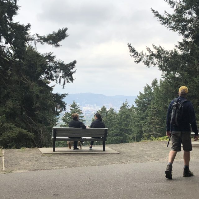
Andy and I hiked through Mt. Tabor on a Saturday morning and covered 4 miles of trails. Different from hiking in wilderness where views consistently open to broader expanses of nature, this urban hike presented phenomenal cityscapes. Mt. Tabor has well-placed park benches and we passed people taking time to look back on their city. I am slow to realize things, and it took me until I was 60 years old to understand nature can also help us appreciate the constructed world. It is obvious the architects of the park took time to make this point by laying out key landscape features to frame city views.
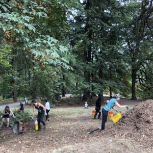
The biggest activity in the park the day Andy and I hiked through was being driven by a large group of park volunteers. The volunteers were were prepping the park for autumn and cleaning up the causalities of a long hot dry summer.
–>Here’s another bit of advice I’d give to someone looking to move to a new city: consider someplace that is not afraid to be silly and where volunteering and activism is as common as the rain.
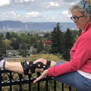
My second time through Mt. Tabor Park I hiked with my friend Lori, who was touting a Victorian style knee brace. But Lori is ever the optimist and I am not quite sure what would ever slow her down. During our walk she found something else injured, a lamppost, and we admired people’s futile attempt to save it (more silliness).
I am learning something about feet-to-ground (hiking/walking) and hands to ground (yoga) that sparks my mind and memory. But I don’t have much more to say than that right now, I’m still figuring it out, & maybe there is nothing more to it than just that. I can say that Lori and I talked for 4.5 miles and 28 stories (iphone app) as we randomly moved from trail to trial. It was a stunning fall day enhanced by the surrounding nature, a vibrant friendship, and perfectly framed city views.
Urban hiking involves sharing the road a little more than hiking in the forest or on remote spits of sand. There are children, hordes of volunteers, and cyclists all of whom can step into and out of your path from moment to moment. But rather than this feeling like a nuisance, it really is a glorious mashup of nature, fellow citizens, and the city that surrounds it.
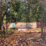
Portland City Hikes (#1) – Tryon Creek State Park.
September 18, 2018
Summer 2018 was filled to the brim with challenges, and I discovered my sixth grade English teacher, Sister Gabriel, was right again –with every challenge comes a valuable lesson. Here was mine:
I had the crappiest boss ever this summer. For months she made work miserable, spewing verbal abuse that she followed up with days of complete silence. I likened her to the classic abuser boyfriend who had perfected the “beat-up the bitch then sail into the honeymoon” cycle. Here is the lesson I learned, an interesting friend does not naturally translate to a good boss.
Her instability had my gut in knots and I was disappointed in my inability to act and simply walk away. I told myself next time she called me an embarrassment I would quit. And like the common batterer returning to the boxing ring, she threw her go-to punch. And then I quit.
I had planned on stopping work next summer, so I was not completely unprepared for not-work, yet it’s a little earlier then I had anticipated and it happened quickly. So I admit to being caught a little unprepared; it is as if I had a small amount of wind knocked out of me. For now I am willing to let the days unfold quietly as I catch my breath. (Did you know this is what you should do when you are lost or stranded – unpack everything you have with you, lay it all out, and contemplate what is available to in front of you that can be of help).
While I don’t want to set large goals now, I do want to lay out some small milestones, you know to set some guardrails. So here is something I have set my cap for, I’ve decided to take local hikes, Portland hikes. Not hikes out in the country or up on Hood or further afield in Washington, I am going to focus on local hikes –around the corner or across the river.
I took my first city hike yesterday on September 18th at Tryon Creek State Park. The park is just a little over 650 acres and sits across the Willamette River from our house, north of Lake Oswego and snuggled into Portland’s southwestern canyons.
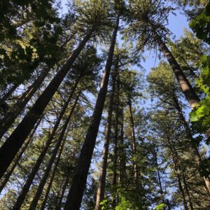
The area that makes up Tryon was originally an 1850 land claim which was later sold and logged. Some of the roads used by the loggers back then are trails hikers use today. In 1900 the upper part of the land parcel burned and the old snags remain in place, you can see them from the trails.
Tryon is an example of why Portland is one of the best cities in the US. There is plenty of culture and fun to be had but politically there is a serious focus on supporting and maintaining natural areas. Tryon is a preserved parcel of typical Willamette Valley ecosystem and it is used extensively for public study and education and….recreation. Dogs, horses, bikers and hikers are all welcome. About 350,000 citizens visit annually. There is a nature center that anyone can use. I spent time there with my girl scout troop around 1971 before Tryon became a state park.
There are nearly 300 plant species in the park and 90 types of wildflowers. The trees in the second growth include alders, maple, Doug Firs, red cedars, and hemlock. There are more than 50 species of birds and small mammals in the park including beavers. Tryon Creek is one of the few creeks in Portland with a run of trout and salmon. This is a humbling list, an awe-inspiring outcome of people’s work to protect this parcel of land and make it available to everyone.
I took the big loop trail and hiked up and down the canyon. Unlike hikes in the coastal range or Cascades some of the hikers I passed were in flip-flops and carrying iced drinks from the coffee shops down the road. There were plenty of mothers too, leading children and naming trees and fern species, and occasionally stopping everyone in order to listen to woodpeckers.
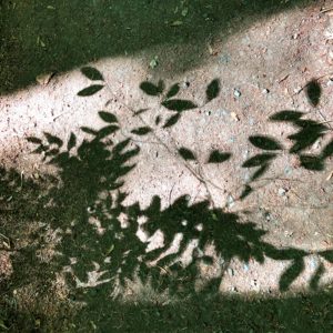
I was captivated by the early fall light that fell through the trees and the patterns it made on the forest floor. Komorebi, even saying the word brings a wave of calm.
I passed others with cameras pointed at autumn colors and at the remaining late blooming species of wildflowers. It was a bustling park but for many stretches I was on my own. Despite my stiff ankle and cranky knee that day I was able to move easily in and out of the warm yellow light and cool shade. The air is finally fresh again in Portland after a long summer of suffering from wildfire smoke. And all of it at that moment, the light, the shade, the cool on my face, knowing the effort people put forth to assure this park in the middle of our dense city is available to everyone, well I felt renewed, unscathed by the challenges of the summer. And at the end of my hike, I took the time and a seat on a fallen tree trunk and let the light fall through the trees, onto my head, my lap, my feet.

Bucking the Heat
“It’s not about the destination, it’s about the journey”. You’ve heard this one, right? It is a saying used so frequently that it can often be mistaken as white noise.
I get it, we run around too much and don’t take time to enjoy the present. We are too busy and would benefit in so many ways by slowing down. We need to relearn how to appreciate what is in front of us because longing for what we don’t have is the source of all misery. The sentiment of the saying is not lost on me. I appreciate the reminder here and there.
But you know what? Sometimes it is about the destination. Take for instance last Sunday…
We had our first heat wave of the summer last week and Portlanders sweated their way through three consecutive days of commanding heat. And on the third day, the meteorologists all warned, a record would likely be broken as they were confident Portland would exceed the 100 degree mark.
If you are a US citizen who lives in a place other than the Pacific Northwest, two days of 90 degree heat followed by a day of 100 degrees may be nothing but a sweet little summer bump in the road. But for those of us used to cloud cover and an annual average temperature of 64 degrees, that kind of weather is almost unforgivable. For example, air-conditioning is not a given, in any place. In fact, we don’t have an air-conditioned house but we are lucky in that our house is a good piece of 1940’s craftsmanship. The walls are solid and the windows are arranged so that the evening breezes move efficiently throughout the downstairs. And it helps that the nights often cool down into the low 50’s.
But when faced with back-to-back days of high temperatures the house inevitably gives up and lets the heat linger in corners and eventually allows the heat to make itself at home in every room. And so it was on that third day, early Sunday morning, I padded out from the bedroom into the dining room bleary-eyed to feed cats and took time to read the thermostat. It was 76 degrees indoors before 8AM.
I moved through the house drawing shades and blinds and closing all the open windows to trap the coolest air of the day. And then I went about the task of convincing Andy not to prep for the following day’s work schedule but to escape with me somewhere into the cool.
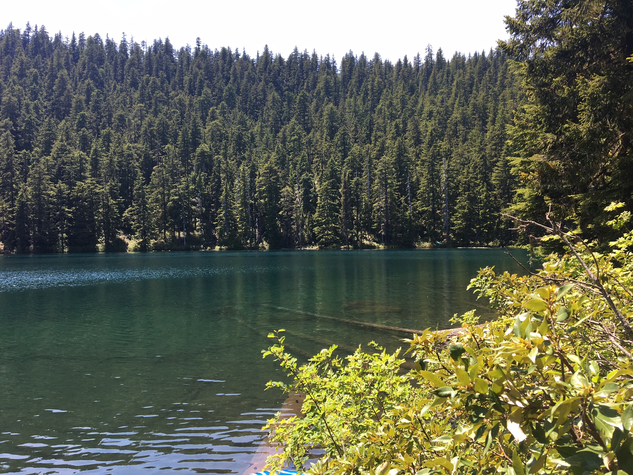
Buck Lake.
It’s a semi-secret lake. You can Google it and get directions, but you have to know about it first. And then you have to have the determination to follow the damn crazy directions to get there.
I drove and Andy navigated, unraveling the following directions whilst looking for the poorly marked forest roads:
Take 224 through Estacada and at approximately 20 miles turn onto Forest Road (FR) 57. From FR 57 drive approximately 7.5 miles to the junction of FR 58. Stay left. Then at the junction with FR 5810, turn right. Drive east until FR 210. From there it’s just another mile to the trailhead.
Only two of those Forest Roads were marked. We backtracked a few times. More than once we ended up on a road that was crowded with fallen trees and pocked by burst asphalt only to eventually spy a sign directing vehicles to turn around as the road was no longer maintained.
We muttered to one another when we had to turn around on a precarious road, this is how people get lost and die in the wilderness.
Buck Lake Trail.
Length: 1 mile roundtrip.
Elevation change: 310 feet.
Location: At 4000 feet, somewhere around FR 210 in Clackamas County in Mt. Hood National Forest. Good Luck.
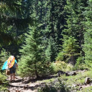
Yep after all that driving, you still must hike into the lake area. The trail is steep and rocky at the outset making it difficult to carry coolers and floaties. Plus you’ll be pretty pissed about the drive in and that won’t help your footing. So watch your footing because if you fall and break anything it may be difficult to make it safely to civilization with one driver and an incapacitated navigator.
And you know at 4000 feet you’d think it would be cooler than what it is.
The trail does become easier- not quite as steep, not quite as rocky -and the shade gets better as the trees get bigger. Yet even then the trail certainly feels much longer than ½ a mile so go ahead and send a kind-hearted husband ahead to assure you are on the right trail, because today probably has not been a lucky one for direct routes. It would surprise no one if you have started out on a wrong trail.
Be sure to thank the heavens (at whatever point on the more-than-likely-longer-than-a-half-mile-trail) for a good partner who also happens to be a capable scout and has an ability to cleverly frame uncertain messages so that they sound more positive than what they really are. “I see a clearing”, he may say all sweaty because he has run ahead fleet-of-foot and back again so you are not alone for long on the trail.
Because you are weak, you may jump at the positive tone of the message but think again about that sentence, “I see a clearing”. You know, it is not the same as “I see the lake”. Force clarity: “Does that mean there is a lake ahead?” Do not be surprised at an impish grin, he is good but he is also mischievous.
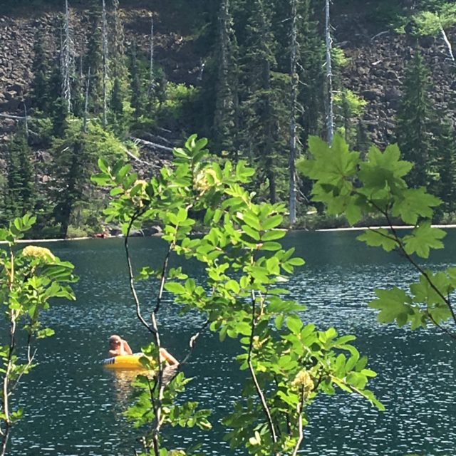
Sometimes the journey can suck, but the destination is well worth it. And as you paddle about in a perfectly clear spring-fed lake be sure to tell yourself, well this time it was all about the destination. (Even though now from this point in the storyline the journey can be re-framed as satisfyingly adventurous).
Then go enjoy chocolate chip cookies, bbq Pringles, coke-a-colas, and the Sunday New York Times under a canopy of old growth trees. Wait out the final hours of the heat wave in the gentle embrace of the trees and an aqua lake with the one you love best.
========================
C has a new word.. “Shinrin-yoku”
Preamble:
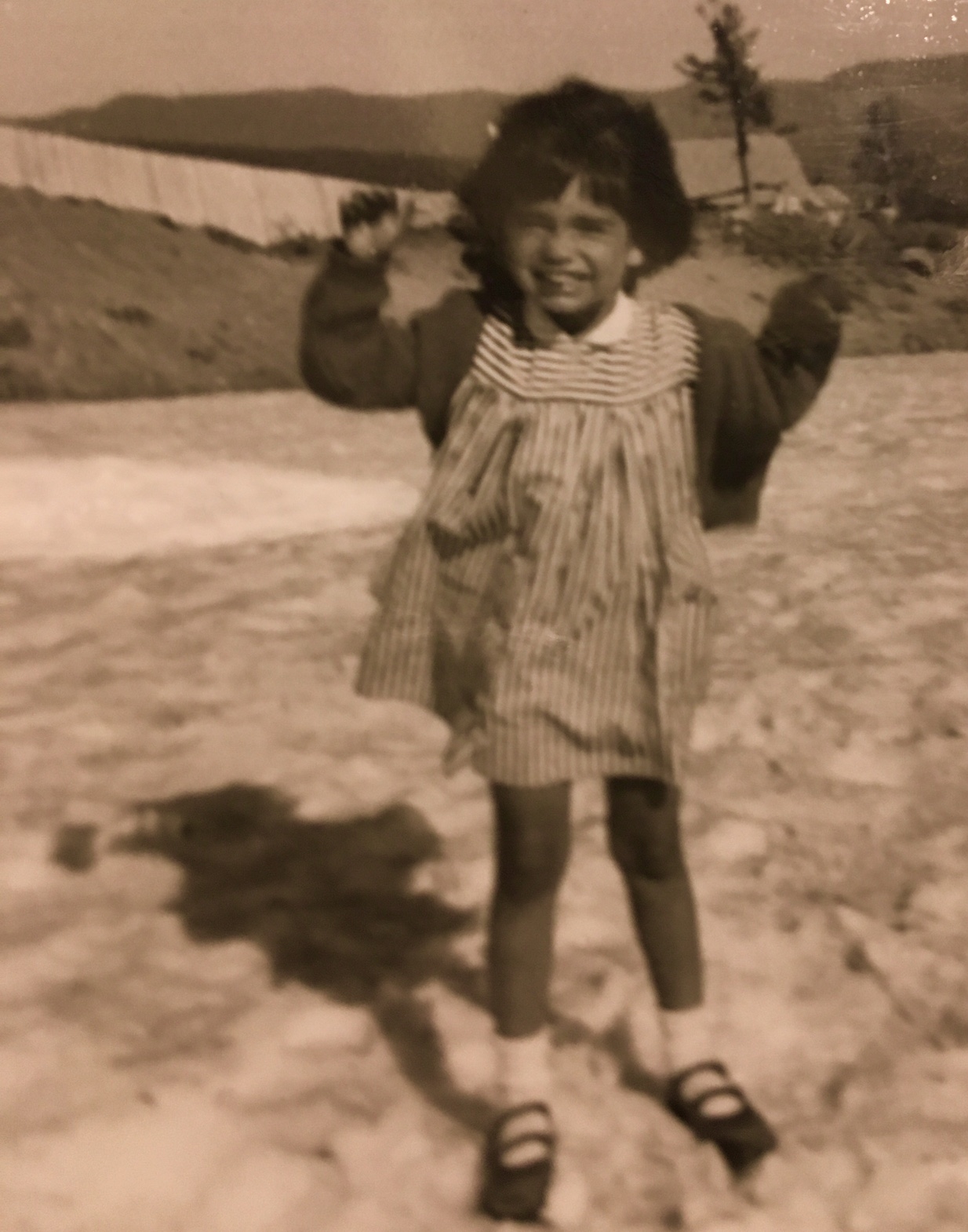
I started hiking when I was a young girl. There are pictures of a day when I walked partially up Mt. Hood with my father. I was 4 years old and I remember the day well for a variety of reasons: I was in my favorite dress and was sporting my beloved red leather shoes with buckles. I was confident I sparkled in the eyes of other hikers. I also remember my mother walking away, to wait in the lodge, and I had to decide who I should accompany.
I decided to stay with my father and head up the mountain. He wasn’t much interested that I was tagging behind (maybe there were some good-looking women ahead?) but no matter I had a spectacular time. I wandered off the trail at will chasing after little things that caught my eye, which were mostly patches of snow that had managed to self-preserve in the Doug Fir shadows. When I caught up to my father at a resting rock he scolded lightly about lagging behind, but his words didn’t faze me. I was bursting with the thrill (edged with terror) of having been in the woods for those brief moments, on the side of the mountain, all alone.
After moving to the Midwest, I didn’t hike much. After years of feeling lovingly enveloped and cooled in the forests of Doug Firs, cedars, and hemlock I found the open prairie scared me. The prairie landscape felt over-exposed and made me feel inexplicitly vulnerable.
It took some time but I eventually came to see the beauty of the Midwestern vistas (although there is still nothing that I fear more than driving at night in the prairie). I reset my eye and mind, and as Mike says I finally “found the beauty in the open spaces”. (Cue Miles Davis music now, as it certainly is the music of the plains). Nonetheless there was always a place in me that longed for the sensation I had as a 4-year-old, alone and enveloped by a still and deep green forest magnificence.
The Hike:
- Old Salmon River Trail in the Mt.Hood National Forest.
- Hike Type: Out and back
- Distance: 5.0 miles round-trip
- Elevation gain: 200 feet
- High Point: 1,640 feet
I drove to Welches, Oregon on an early Sunday morning in June when Andy was out of town. Welches is a village in the Mt. Hood corridor, less than 40 miles southeast of our house. Welches’ neighbors include the villages of ZigZag and Wemme. All three places are just spots in the road that support passing traffic and supply goods to the hermits and millionaires alike living in the surrounding mossy forest.
I wanted an easy hike and the Old Salmon River trail is referenced as a ‘family’ trail (translation: if kids can hike it so can you).
I took my time getting to the trail-head. I stopped in Sandy Oregon, a small town that caters to outdoorsy folks. I sipped a cup of dark steaming coffee on a bakery’s wide front porch and exchanged smiles with people bundled up in ski jackets and stocking caps in mid-June. There was a tangible buzz on that porch, seems we were all looking forward to a big day outdoors.
I could see my breath but also feel the warm sun on my cheek. The sky was vibrant blue. I felt my body downshift as I relaxed into the porch chair and hot coffee. I promised myself I would hike the trail exactly as I wanted.
The Old Salmon River trail used to be the main byway into the upper canyon of the Salmon River but just after WWII a road was built to make the access easier. Some of the trail was lost then but the Forest Service has recently restored a major section and this trail is a beauty.
Sections of The Old Salmon River trail run very close to the new road but a few steps in and the forest is upon you and the road is easily forgotten. The old growth cedar and Doug Fir that populate the forest in this area are some of the most stunning specimens of nature you will ever see. And then a few steps further on the trail, you come upon the Salmon River.
The Salmon River is just over 30 miles long and it drains a sizable portion of Mt. Hood’s southwestern section. The Salmon River dumps into the Sandy River which in turn feeds into the mighty Columbia. The entire length of the Salmon River is a protected National Wild and Scenic River and many sections are also protected wilderness. The lower section I hiked supports a variety of inhabitants including black bears, cougars, deer, badgers, fishers, and martens. There are warning signs posted for the bears and cougars with very clear instructions on what to do if paths cross.
The Forest Service has added wooden bridges over small streams and side trails that lead hikers to enticing pools on the river. Small swaths of sandy beach have been added at the wider river bends and I imagine are crowded during Portland heat waves.

I took my time on the trail and along the way I tried to name all the trees, plants, and flowers I could. (I didn’t do well but next time I vow to be better studied). I also stopped whenever I spied an alluring resting rock along the river and I pulled out my book on…martens. (Book report soon).
The trail was not crowded at the beginning of my hike but traffic picked up as the day progressed. However, there are so many side trails and resting rocks and sandy river beaches that I never felt more people than nature. Most people like me were taking their time and wandering off on the multiple offshoot trails.
Shinrin-yoku is a term I recently learned, it means “taking in the forest atmosphere” or “forest bathing.” It sounds crunchy but Asian researchers insist that there are tangible health benefits from spending time under the canopy of a living forest. I love the notion that a simple stroll through the woods can improve health.
I will never be able to adequately express how rested and invigorated I felt as I drove home after my day on the Old Salmon Trail. I was so happy and satisfied. I could not quit smiling. I felt connected to my earliest days of wide-eyed wonder at the forest. I am delighted that sense of awe is alive and thriving within me and I will nurture that spark until I am pushing up daisies (hopefully from the forest floor).
==============================================
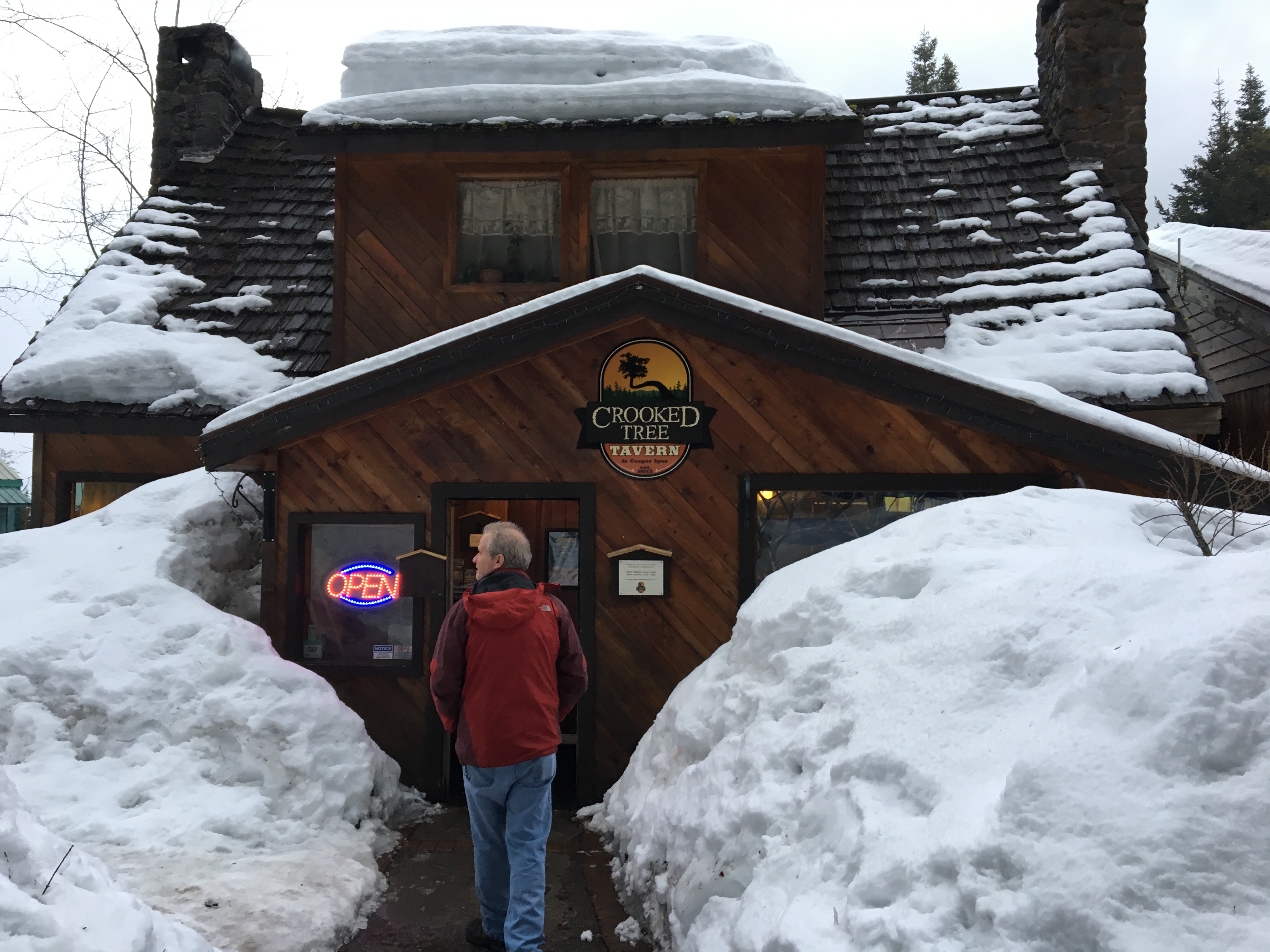
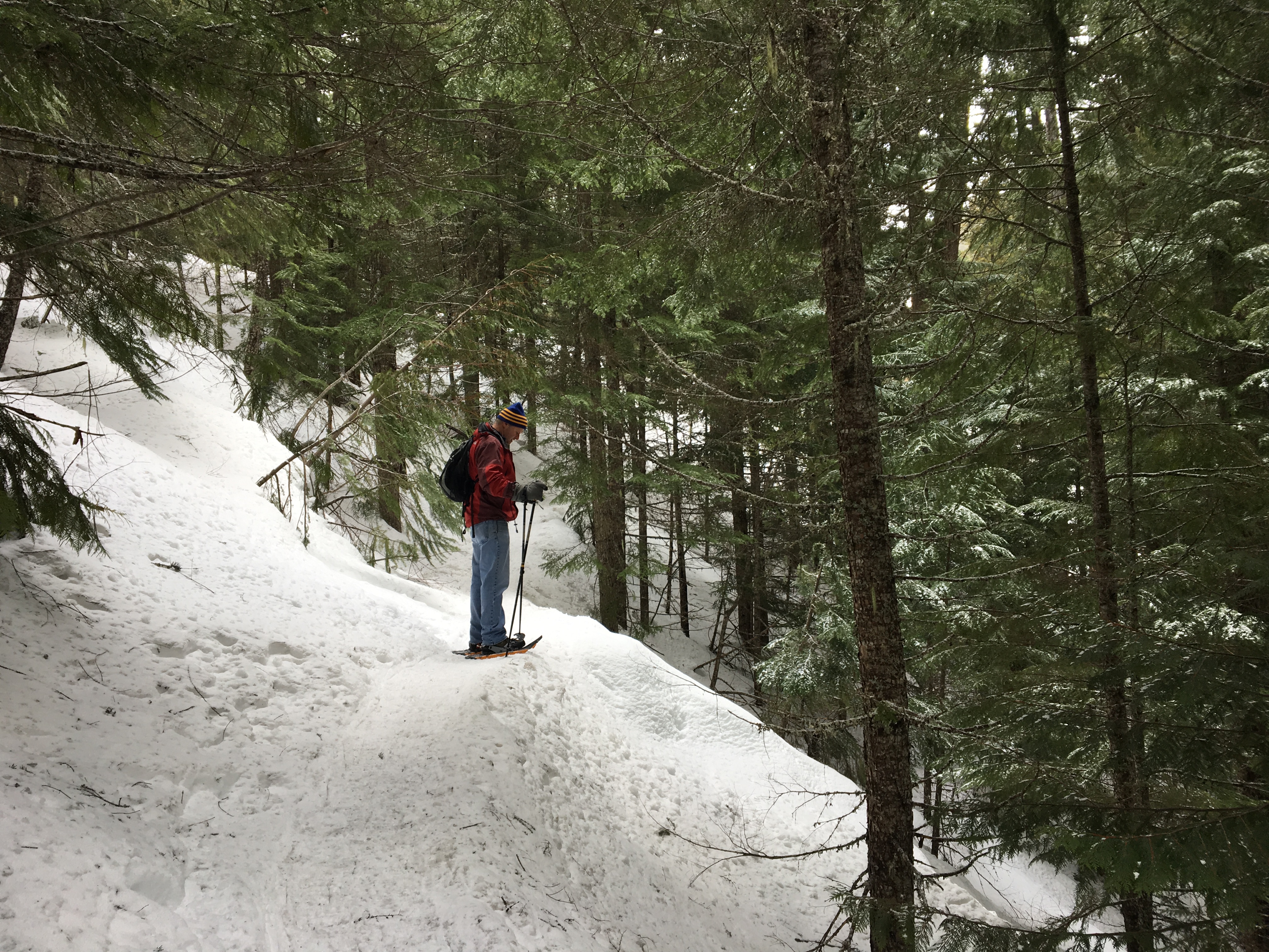
C writes about her first snowshoe hike with Andy on Mt.Hood, March 4, 2017 (with a small preamble).
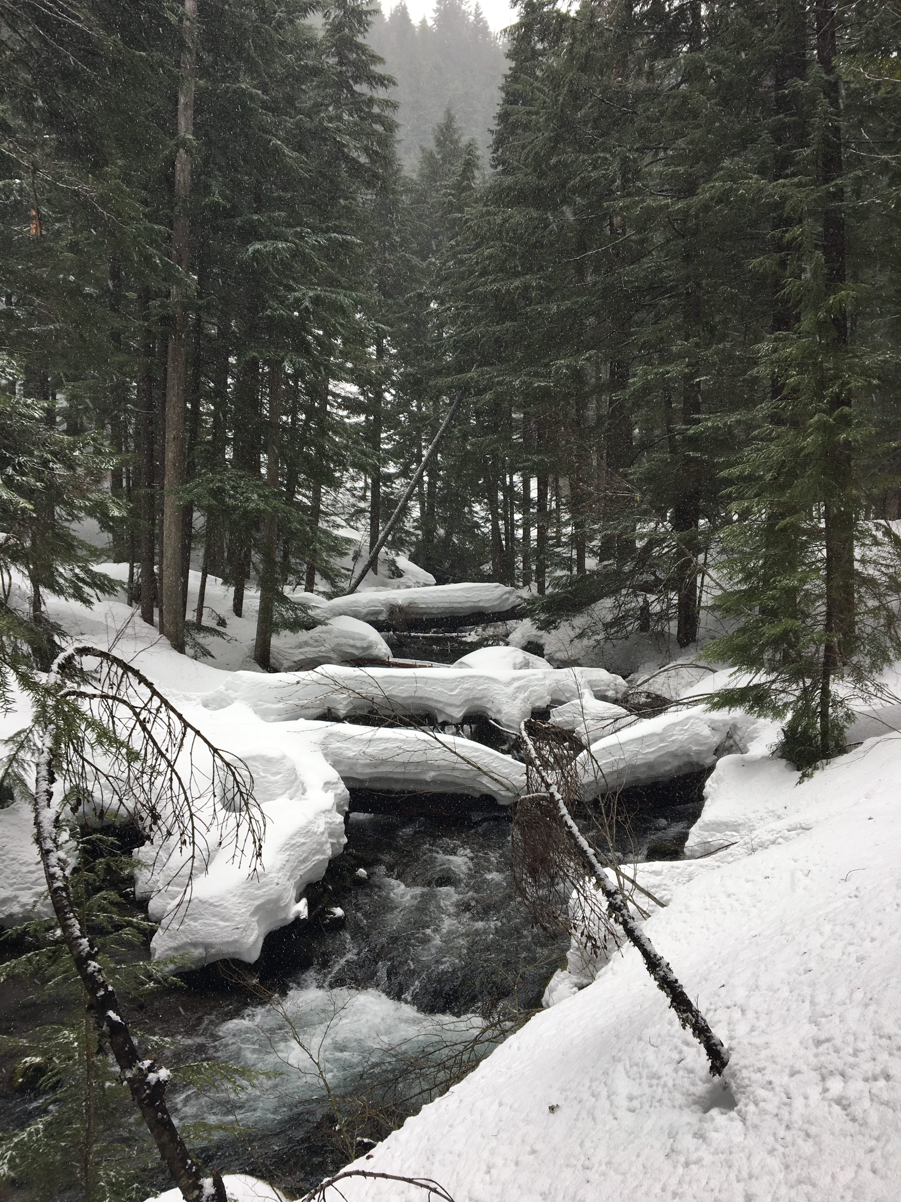
The Tamanawas Falls stats:
Total Distance: 3.80 mi
Trailhead Elev.: 3,020 feet
Net Elev. Gain: 500 feet
Trail type: There-and-back
Trail condition: snow packed with light snow falling
Did we finish: Are you joking? That last part was steep. Next time. Read on if you would like.
Preamble: I moved home in 2014. I had been gone for over 40 years but home is Oregon, it is in my DNA. I hugged the ground in the backyard of our beach house not long after I returned and it was the closest I have ever come to a spiritual revelation. And not two days later my dearest childhood friend, whom I had not seen in 40 years, crossed that same backyard brave and tall with arms extended. “I’ve been wondering when you would come home,” she said and we held on in silent tribute to our lost days.
Then not too much later, as if her duty was complete, my long-lost friend disappeared into the mountains and Ponderosa pine forests of central Oregon with a neighborhood boy from our youth. I felt duped, hadn’t we just crushed the missing years between us in our long embrace? It took a while for a gentle realization to spread through me, I liken it to seeing a play with a cute trick, one in which the audience has been led to believe one thing (e.g.; I was the center of the story) when all along there had been other plots in flight (in this instance, the Cindy and Steve intrigue).
That was nostalgic romance (or nonsense) on my part. The real story is Cindy and Steve had a story all along. I simply had not been there to witness it. When I stepped back onto home stage I was oddly surprised to find all the stories I had been a part of as a young girl had continued without me and I was no longer a central player. (Foolish, yea? Well I was 45 when I could finally admit that I just might not live forever. So chalk it all up to being a slow learner.).
I should have known that I could not artlessly reappear and somehow intuit and maneuver back into plot lines decades old. And with that realization taken root, there is a new part of me that houses a melancholy acceptance of having missed being a part of countless arcs that were snatched away from me when we moved to the Midwest. This is what Don DeLillo has to say about that:
“It is possible to be homesick for a place even when you are there.”
― from White Noise
The one thing that has remained unchanged is my connection to the land. There is so much joy in that familiar: the sound of splashing streams, the smell of the ocean air, the pine-scented wind, the white-grey fogged mornings, and the majestic rise of Mt. Hood over the city that has always been my home.
It is because of this enduring relationship with the land that walking over it, and even under it, (try a hike through a lava tube sometime) has become essential in reconnecting with home and with myself and with Andy in what is a new world for him.
For my birthday, Andy splurged on snowshoe equipment even though the recreational snob who worked at REI urged us to try rental equipment first. “Fuck him,” Andy said in a tone as kindly as those words would allow and then shelled out a pile of money on equipment we weren’t quite sure how to use.
People will tell you that snowshoeing is just like walking and they are mostly right. You can buy/rent equipment, watch a YouTube video or two, and then hit the snowy trails. You may not be as fast as some of the more experienced, but you won’t look the fool either.
The Hike
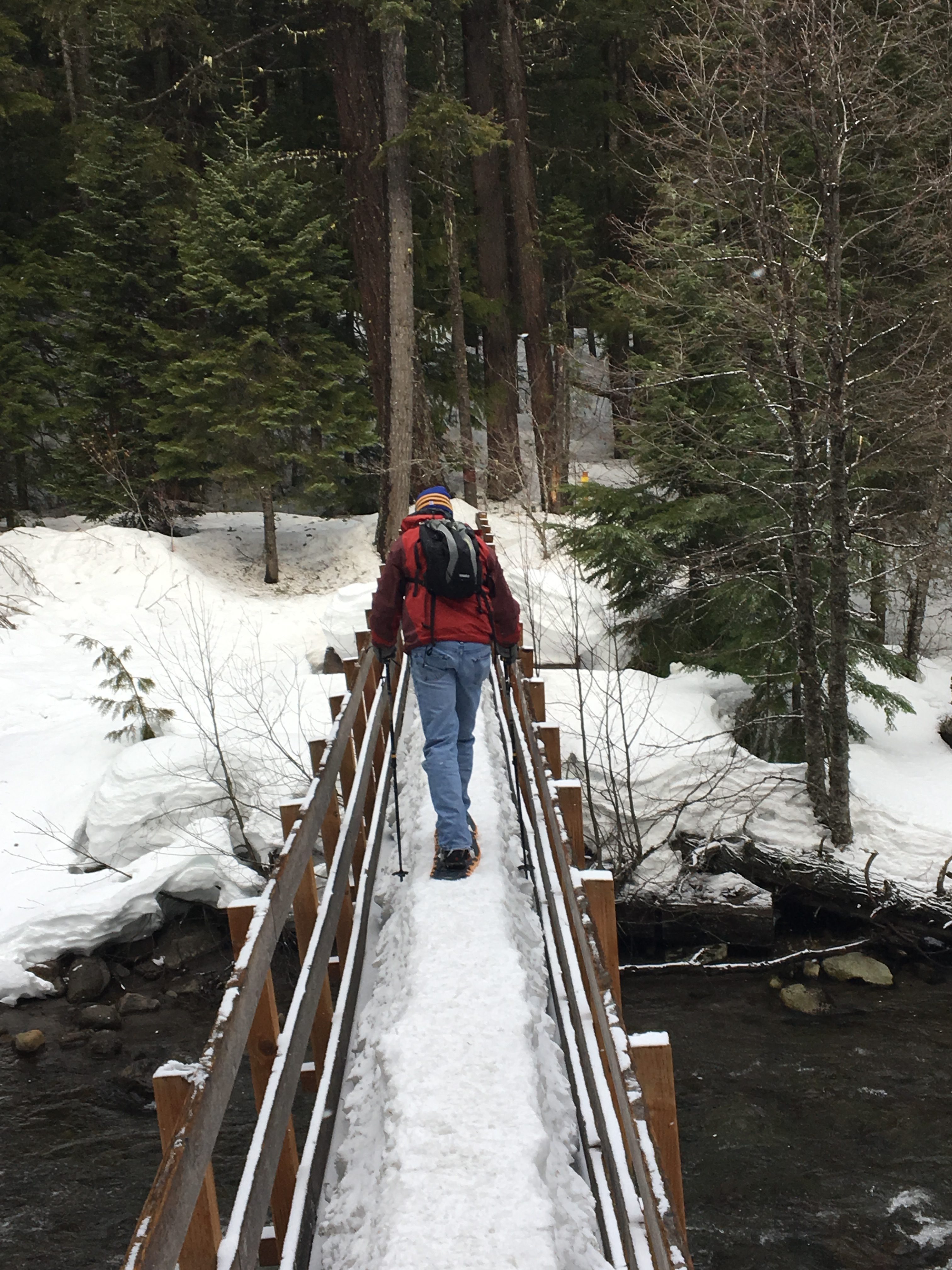
On our second day of snowshoeing Andy and I went to the Tamanawas Falls trail on Mount Hood’s east side. The woman who worked the lodge where we overnighted assured us this was a beautiful and a relatively easy snowshoe hike through old-growth forests. The trail is a gradual incline to the falls and we passed easily under Douglas fir, cedar and hemlock wearing fresh snow. We crossed a few bridges (gracelessly) and were kept company by the Cold Spring Creek which was running fat and fast.
It was silly beautiful in a way I had never experienced Mt. Hood before. It also felt a little dangerous – Andy and I were sure the big boom we heard was an avalanche somewhere and from that point I kept a rum eye up the mountain –but if pressed I couldn’t say what we would need to do to protect ourselves if one roared our way. We didn’t see a lot of people on the trail but those who passed, well they were a happy lot-bright greetings, genuine big smiles, glad to take multiple stops for weed, wine, and selfies.
I loved the new connection to Hood in the winter and the new experience with Andy. It was a beautiful day with light snow falling on our mountain in our state and on our way home we made plans to return again and again.
J writes…
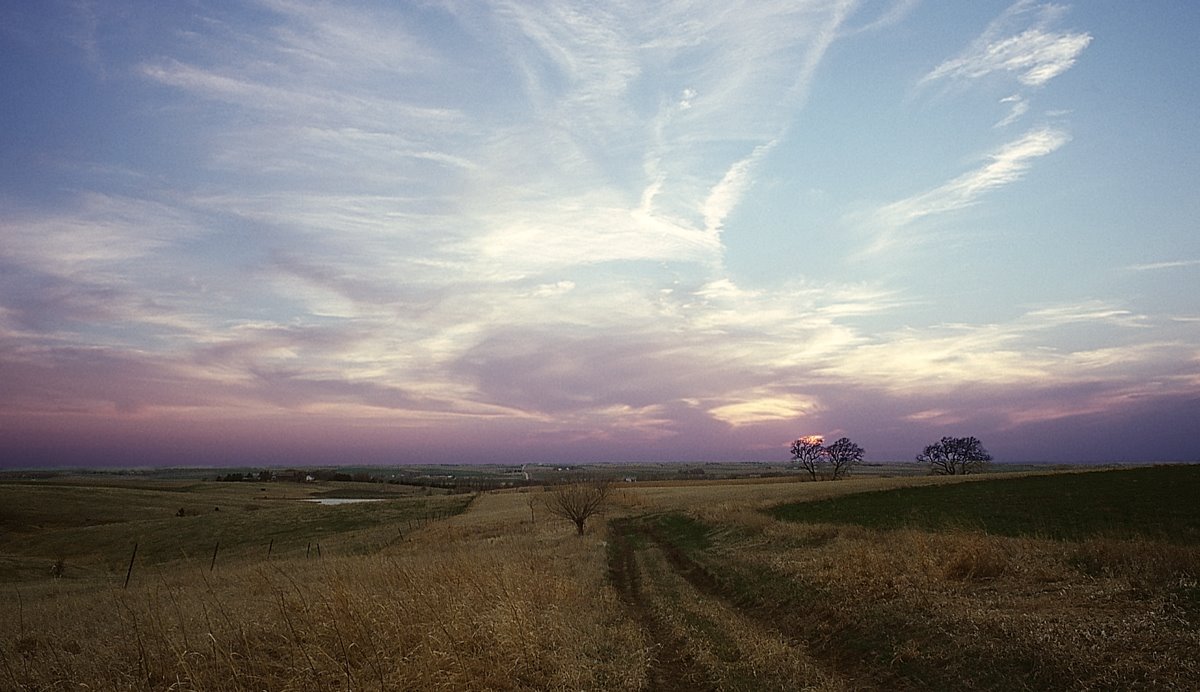
February Bike Ride, or, “Der”
I am going to write about things you already know.
That global climate change is real – not an opinion – and that it’s worrisome to have a span of summer-like days in the middle of what should normally be the coldest month of the year.
But also, how wonderful it is to get a nice day in the middle of February, just when many of us are about to sharpen up the axe to use on our families.
Today, on the third day in a row the temperature here on the plains hit 70, I pumped up my bicycle tires and hit the trails. I rode past people doing yard work and washing their cars. I rode by walkers, runners, and other bikers who could not help but flap their hands in enthusiastic waves of recognition about how we strangers were enjoying the sun and warmth. “Hello again, do I recognize you from the warmer months? Maybe not, but let’s share the path anyway. Take care. See you in the Spring,” the wave said.
I report (with serious consternation for our plant and animal brothers and sisters) … the February bike ride was awesome X 100.
C. on… not-hiking

This is a brief entry on not-hiking because I have been doing just that since mid-November. I busted up my ankle rather spectacularly right before Thanksgiving and a big plastic clunky boot along with slowly healing old(erish) lady bones can put a real damper on enjoying a trail.
To tell the truth the down time hasn’t been that horrible. Here’s one reason why: whenever I was forced to acknowledge or deal with the big grey boot (i.e.; everyday) I frequently pictured my friends and acquaintances who had been laid low by Mr.Death and how they would have gladly opted for a broken ankle. I can’t even say ‘my friends that got sick and died just like that’ (finger snapping for added emphasis) because the diseases and illnesses that carried them away generally took their damn time. (Exit stage left…slowly…slowly…one more grimace please before the final bow; that’s it! Now scram. Forever.)
So while not-hiking I smiled for my dearly departed friends when any one person (and there were many) would acknowledge my big boot and murmur sympathetic words. I thought of my friends so much I ended up creating a phantasmagorical scene in my head where they were given the choice of a chipped-up tibia or a lethal dose of cancer. An other-worldly do-over if you’d like. This mental one-act took my mind off not-hiking and allowed me to envision long-gone friends with a happy choice in front of them. (“I’ll take door number two!” asserted with the angelic confidence of someone who knows precisely what is waiting for them).
My busted ankle, which made me one with the couch for weeks on end, enabled me to think about my missing friends in a different light – new images of them in a hopeful place with a new hopeful choice (and I acknowledge it was all pretend – but nonetheless…). Weirdly, that is what my smashed up ankle came to symbolize: hope. My own do-over. As I focused on my missing friends I was able to toss out some of the anger I held on to about their absences (angry only because they left so soon). No fear, I am not breaking with the real world, I acknowledge the make-believe nature of it all. But it was a good mental crutch to use during my confinement. And it was a relief to think of friends happily and not with the usual sense of deep loss / of smothering sadness I seem to have embraced for many years.
And now my father is sick too, probably nearing end of life. Cancer is cutting down the big D (dad, Don) and has reduced the man to a confused shrunken being muttering nonsense on an endless loop underpinned by a good dose of paranoia. Sorry, I can’t make his cancer story any prettier; and he wouldn’t appreciate the nicety anyway. If the end is long (no swift heart attack, no fiery car crash) modern medicine can quickly turn a vibrant person into a clucking confused being with dull eyes and knotty hands worrying the edge of hospital sheet. The long stroll toward death can strip people of their privacy and dignity (in exchange for a few more days, another month). I have witnessed numerous (otherwise considerate) humans walking into my father’s hospital room only to comment on his urine output or shout questions like ‘how are you feeling today’ as if he was dying of deafness and not multiple myeloma.
I am not especially close to my father and during my formative teenage years he wasn’t around so I don’t have a strong familial tether to him. But I acknowledge that many of the moments he and I shared helped shape the better parts of me.
- I am brave because he is brave. ‘Look at me! Just look at me’ he shouted over the roar of a roller coaster as my 5 year old self whimpered about an upcoming drop. ‘You won’t be afraid if you look at me’. Honest, that image has stuck with me forever and I call upon it when needed. I see his young face, not much more than 30, with his thick black hair lifting in the wind and his face smiling, nodding, encouraging and urging me to welcome the upcoming thrill.
The Big Dipper at Jantzen Beach, the one where I was urged to be ‘brave’. - I am not afraid to enjoy the things that make me happy because I saw him chase happiness his whole life. It is such a simple thing, and yet so many generate reasons that stop them from defining and embracing their own pleasure. My father was a straight up ‘yes’ man when it came to life’s opportunities.
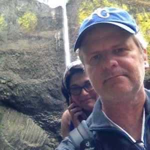
A great source of my pleasure, Anj; and hiking with Anj. At Latourell Falls, Columbia Gorge 2015. - And I do not to spend time worrying about other people’s life choices because he let me know that was, ‘none of your business or mine’. It’s not that I don’t care about other people’s lives, but in one way I kind of don’t care. While not the most open-minded person, my father never gossiped or fussed about what people did with their lives.
- He was inclusive and I aspire to that too. Again, not the most open-minded person but if he came close enough to someone/anyone he always gave a genuine and hearty ‘hello’.
- My deep love and appreciation for the outdoors is the result of his insistence of the importance of being outside as much as possible. He did not approve of playing indoors and most of my childhood was spent outside, even when it was raining, even in the dark.
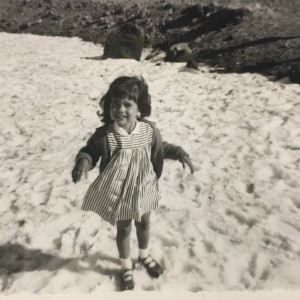
An early hike with dad on Hood, long before child-size North Face wear. Those shoes were my hikers until the buckles rotted off. I had wandered off the trail and played in the snow, much to my father’s displeasure. I finished the hike with achy cold hands.
For one who was often oblivious to the impact his actions had on people around him, my father noticed the smallest details in the woods, the slightest changes on the beach.
So it was appropriate that as I began to bury my childhood grudges with him we opted to get to know one another again outdoors. We started with small walks in grey drippy coastal mornings in the early 1990’s, when I would slip out to Oregon for a week here or there. And we gradually moved on to longer, bigger trails when our conversations became easier and we found we had more to say to one another. If we were alone we would often zip to places quickly on the coast because companions often complained of hours in the car. But he and I agreed on one thing, that hours in a car were often worth a perfect costal view or hike.
He watched the outdoors like a sly detective. He was always present in the outdoors, not distracted as he often was when indoors. He was always looking and he would elbow me with new sightings or announce the information in his overly loud outside voice (often spooking away what he was trying to point out).
It is a powerful human theme that resonates with me this: walk yourself (your relationships, your problems, your fears) to a better place up a mountain trail, along a prairie path, next to a lake or river. And make time to bury meaningless grudges along the way because that weight only draws attention to the unimportant.
As expected, as eagerly awaited, my ankle is growing stronger after 3 months of down time. My goal is to hike St. Helens in the long mid-summer light with my great good Andy, the best hiker buddy and ankle-nurse of all time, and our wonderful new, strong, and funny friends Lori and Jeff.


And on that good summer day, I will remember my long gone dear friends as I haul my happiest memories of them and my healing ankle up St. Helen’s.
I guess this entry, in the end, was just as much about hiking as it was about not-hiking. And I think I owe a tip of the IP hat to Jude (she knows what I mean).
=============================================
J offers… A Penny for Your Thoughts
I was running on my familiar old trail yesterday, one of my main go-to routes, the Rock Island trail. It just reopened after being closed for the last half year for bridge repair. The trail goes right under The Penny Bridge. It used to cost the people riding streetcars a penny toll to cross the bridge to make their way to, what was then, the outskirts of Lincoln.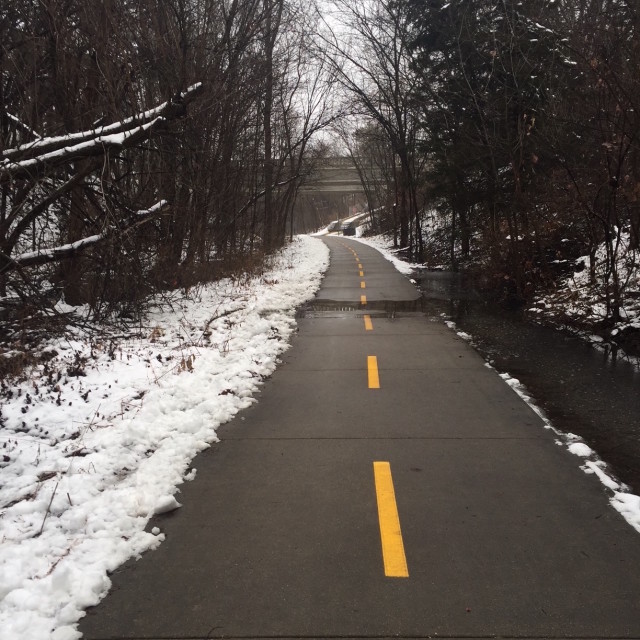
I use running time to observe, to think, to be mindful. Today, as I often do, I was remembering to be grateful that I can run and exercise. I move independently without a thought, but years of working in a rehab hospital have instilled a conscious appreciation of physical health. Wintery as it was, with a bit of a nip in the north wind, it was such a wonderful thing to have the choice to bundle up and hit the trails.
Because the year is coming to an end, I was also taking a mental inventory of things for which I am grateful. I’ve had a few recent conversations with friends about putting 2015 in the rear view. Buh-bye, 2015, and don’t let the door hit you on the ass on the way out. But it also occurred to me, as I was running and thinking, that attitude makes me seem anxious to put more distance from things about 2015 that were precious to me as well as the things that were not. This year gave me a few more laughs with my dear friend Nikki. 2016 will not be able to offer that pleasure. I played hand after hand of rummy with my Mother-in-law in 2015. Sunday afternoons at her dining room table passing the deal and chatting about old times with her are also never to be repeated. In 2015 I shared food, cards, music, travel, conversations, walks, runs, writing, work, laughs, tears, and life with friends and family I know I am beyond lucky to have.
 Running along the trail I came upon some benches I had not seen before. Were they benches? They didn’t quite look right. Then it dawned on me, they were parts of the railing from the old Penny Bridge, salvaged and placed a few hundred feet from where you run under the new bridge. These pieces from the past, once essential to the bridge’s form and structure, are now a new part of the trail. They are just as important as they ever were, they simply have a new place and purpose.
Nice weather for ducks (and running)
Lincoln Nebraska, April 18, 2015
Today was a near perfect spring running day. Drizzly. Overcast. Thunder rumbling far away, as a storm moved out of town (6 or 7 Mississippis away, by my count). The air was damp and smelled a little musty from the morning rain. Wormy. I wish I could blog the smell of the lilacs I ran past in the first half mile. Their perfume goodness literally stopped me in my tracks. I breathed them in. Spring.
 And so went the morning’s run. I enjoyed the song of a tiny bubbling bit of rapids along the Rock Island trail. The camera-shy gold finches and noisy cardinals offered splashes of color against trees just beginning to leaf.
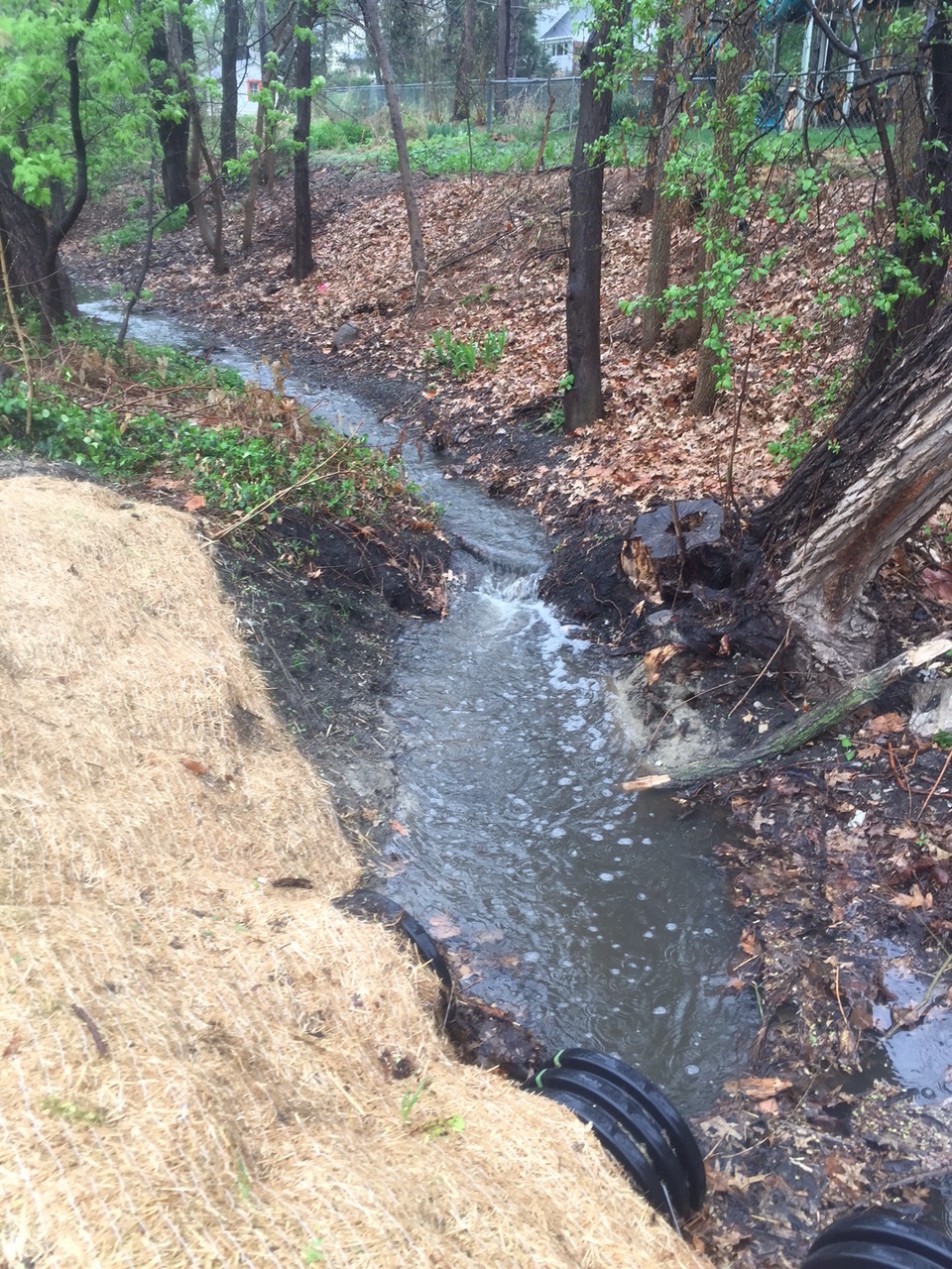
Nebraska doesn’t have breathtaking vistas of oceans or mountains, but the ex-train tracks made into hiker-biker highways, offer these few humble pleasures.
On my return home, I noticed a lone duck swimming in the rain, seemingly enjoying the morning as much as me. Maybe more. We nodded to each other, “Nice day for it.”
Here’s a groovy song for any kind of weather – Lemon Jelly: Nice Weather for Ducks
_____________________________
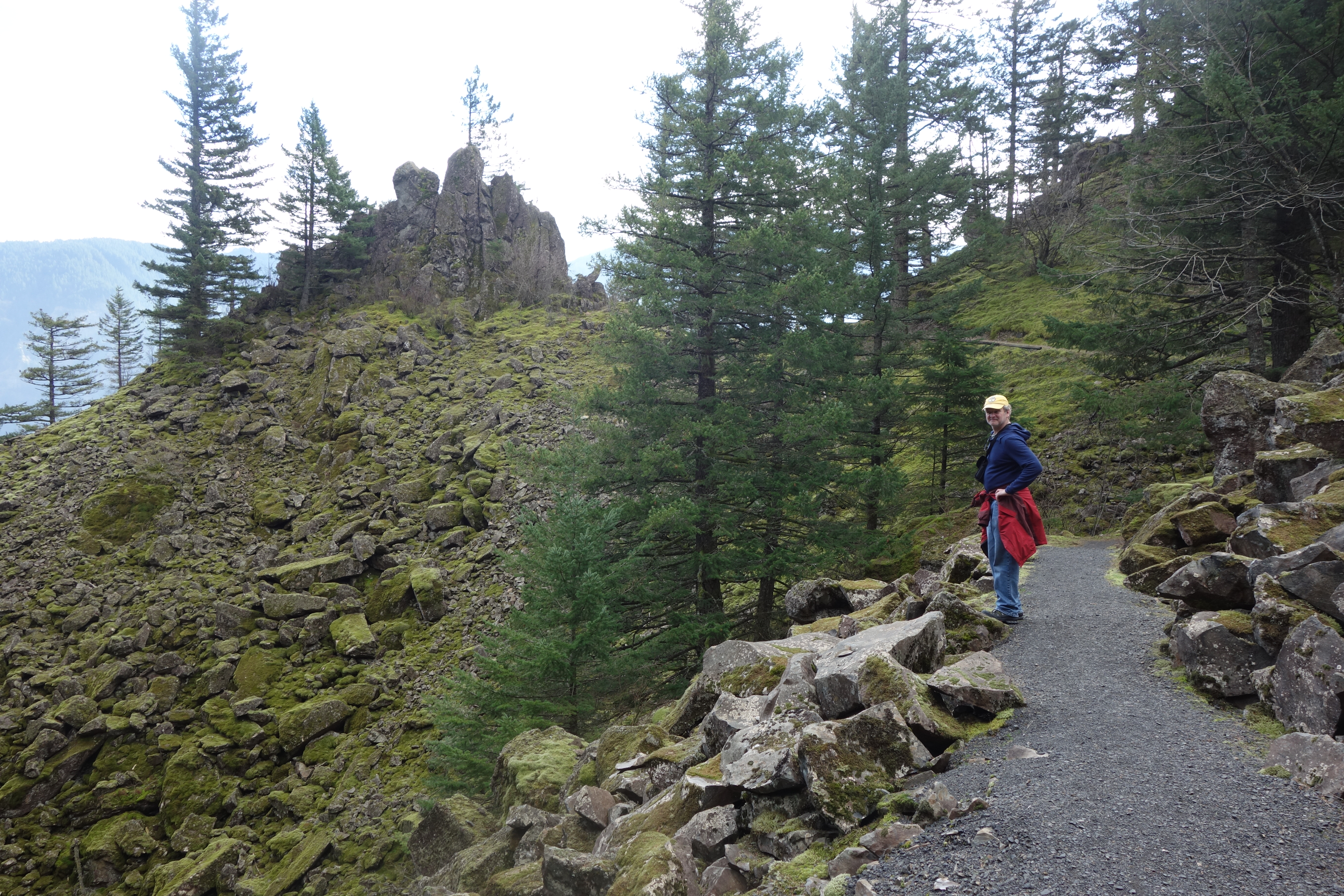
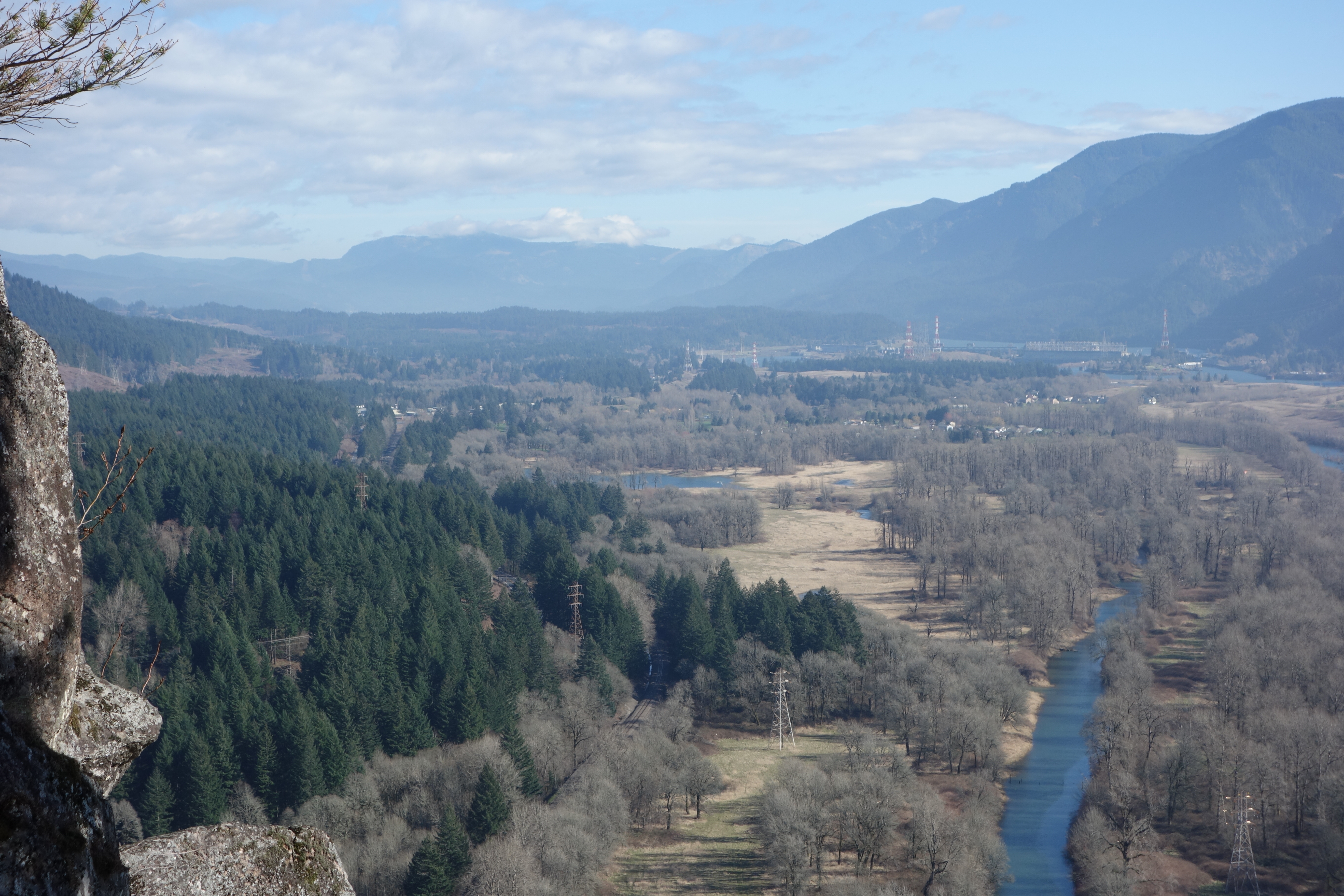
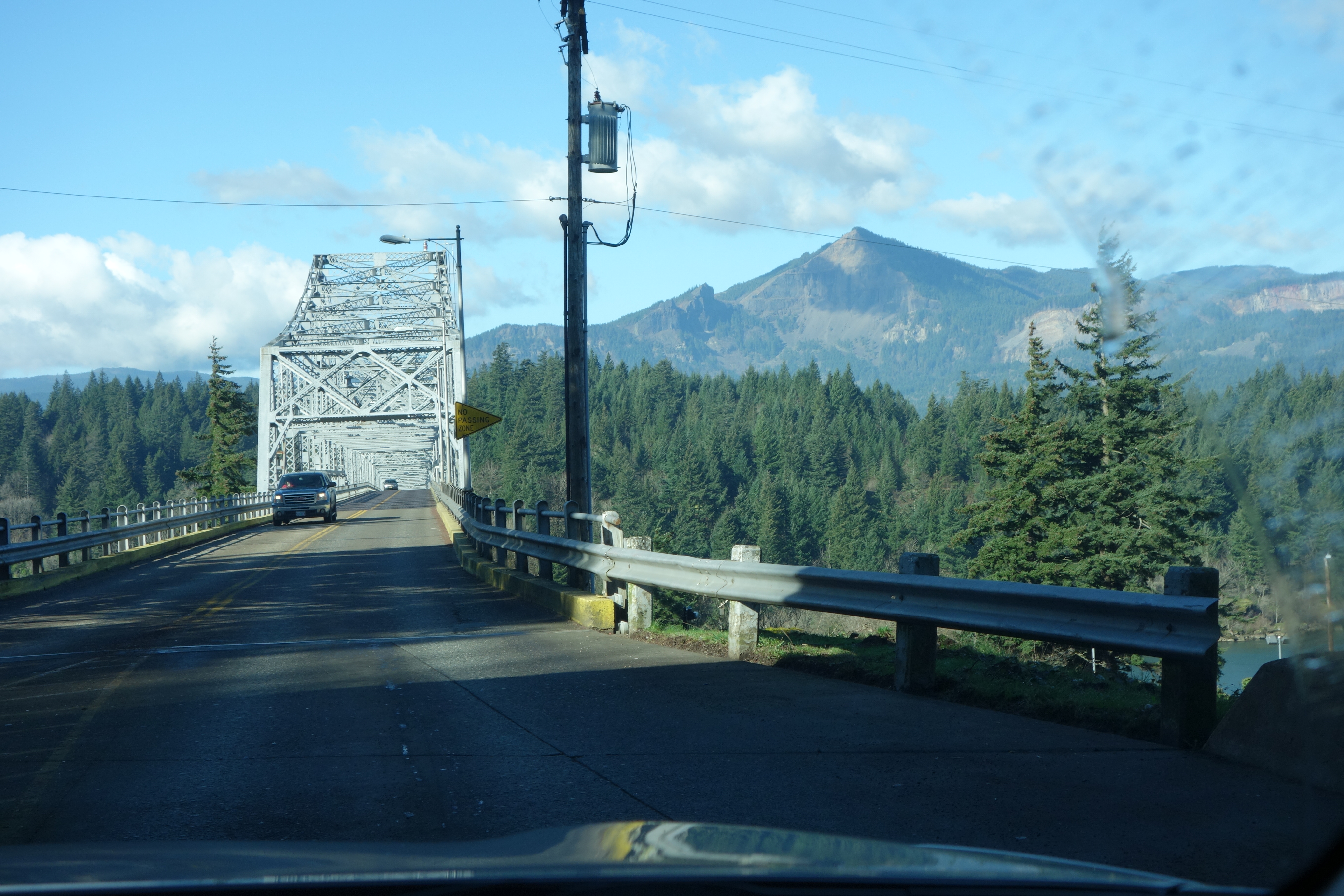
Beacon Rock, Columbia Gorge
![]() Outdoors the sun was mostly shining and it felt and smelled more like spring than winter when Andy and I hiked Beacon Rock on February 14, 2015. It was our first hike of 2015 and it was our first visit to Beacon Rock.
Outdoors the sun was mostly shining and it felt and smelled more like spring than winter when Andy and I hiked Beacon Rock on February 14, 2015. It was our first hike of 2015 and it was our first visit to Beacon Rock.
Guide books say the Beacon Rock climb is a great introduction to the Columbia Gorge because of the views. And there is no denying that the sights from every spot on the rock are stunning. But what is just as cool as this two mile hike is the rock’s backstory.
I first read that Beacon Rock was the eroded core of an old volcano, which adds a certain Land Before Time mystique to the hike. But recently I came across a counter-argument that suggests Beacon is the remains of basalt lava oozing up through cracks in the earth’s crust about 50-60,000 years ago, which still gives it a mighty intriguing beginning. So after being born out of lava one way or the other, the rock was further shaped by the big floods that powered down the gorge in the last Ice Age.
Fast forward about 58,195 years. Lewis and Clark named the monolith “Beaten Rock” on their way to the Pacific. Their moods must have lifted on the way back because in 1806 the explorers changed the name to “Beacon Rock”. (Maybe they were happier because they were headed home. I choose to believe they were moved by the monumental beauty of the gorge and shamefacedly took back their original sad-sack name).
Just less than 100 years later a man named Charles Ladd purchased Beacon Rock to save it from the Army Corps of Engineers who wanted to blast it apart and use the pieces to create a jetty at the mouth of the Columbia. Fourteen years later, in 1915, Ladd sold it for $1 to Henry J. Biddle on the condition he would preserve the rock somehow.
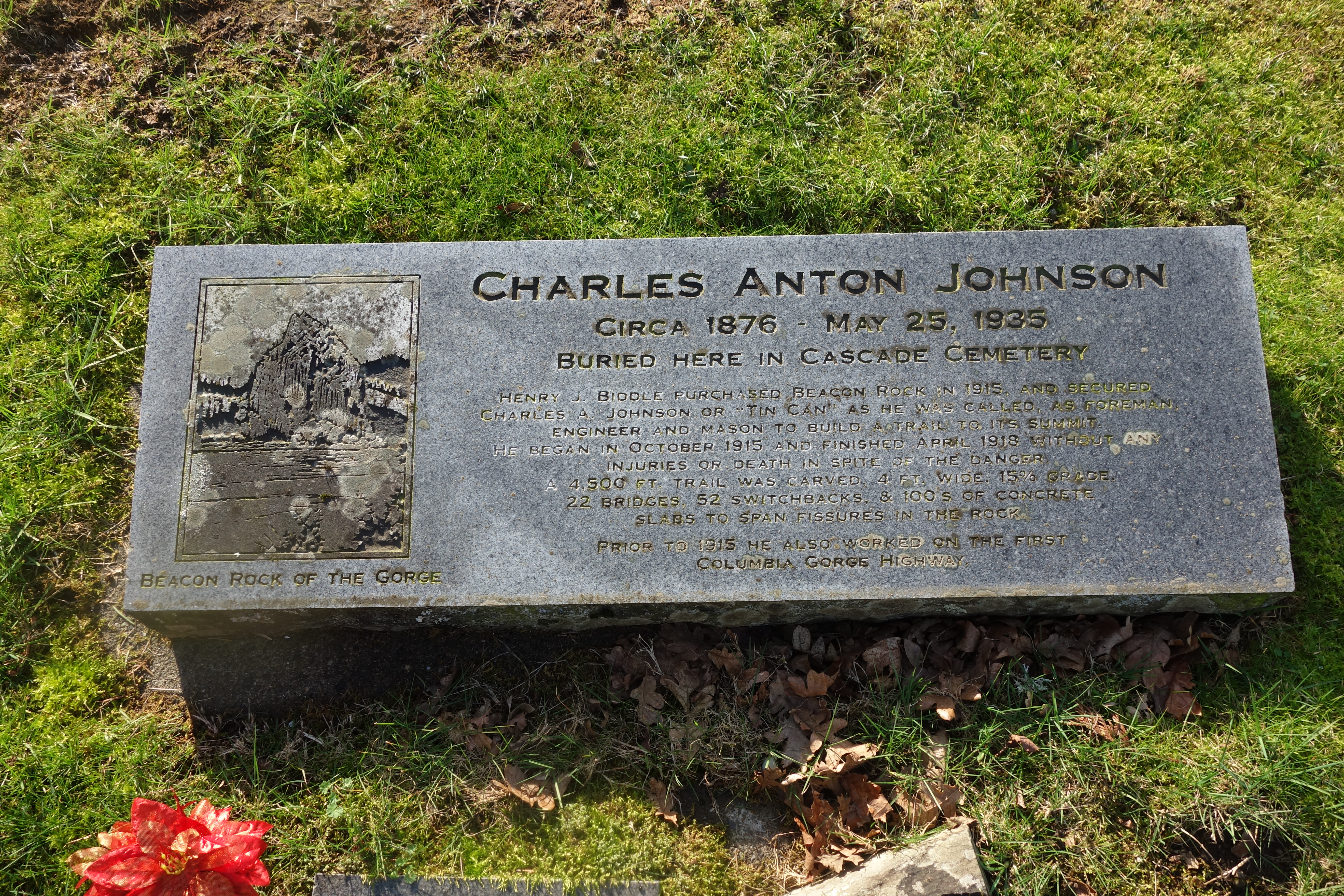
This is how Biddle fulfilled his promise: from 1915 to April 1918 Biddle and a helper named Tin Can Johnson built an amazing array of trails, ramps, stairs and railings to the top of the rock. Although with a name like ‘Tin Can’ you can just imagine who did most of the back-breaking work. In 1935 the CCC improved the routes and construction from top to bottom.
Get this, Biddle’s heirs offered Beacon rock to Washington State so it could become a park that everyone could enjoy. Demonstrating their time-proven elitist thinking Washington refused the offer. But wouldn’t you know it and oh boy par for the course, Washington reconsidered when they realized that the same offer was going to be accepted by Oregon. Babies.
Had the park become Oregon’s it would have only cost you, the Rocky Scrambler hiker, 5 bucks to climb to the top instead of the $10 Washington charges at their state parks. Money grubbers.
Okay, all kidding aside, the rock is on the Washington side of the river anyway so it makes sense that Washington is its guardian, the price is worth it, and Washington really isn’t all that elitist.
It’s an easy hike up with awesome views due to the effort of Mr. Tin Can and his engineering skills and artistic sensibilities. After the hike we visited Mr. Tin Can’s grave at Cascade Cemetery, just up the road from Beacon Rock. His headstone spells out the detail of his inspiring accomplishment: 4,500 feet of 4 foot wide trail, 22 bridges, and 52 switchbacks.
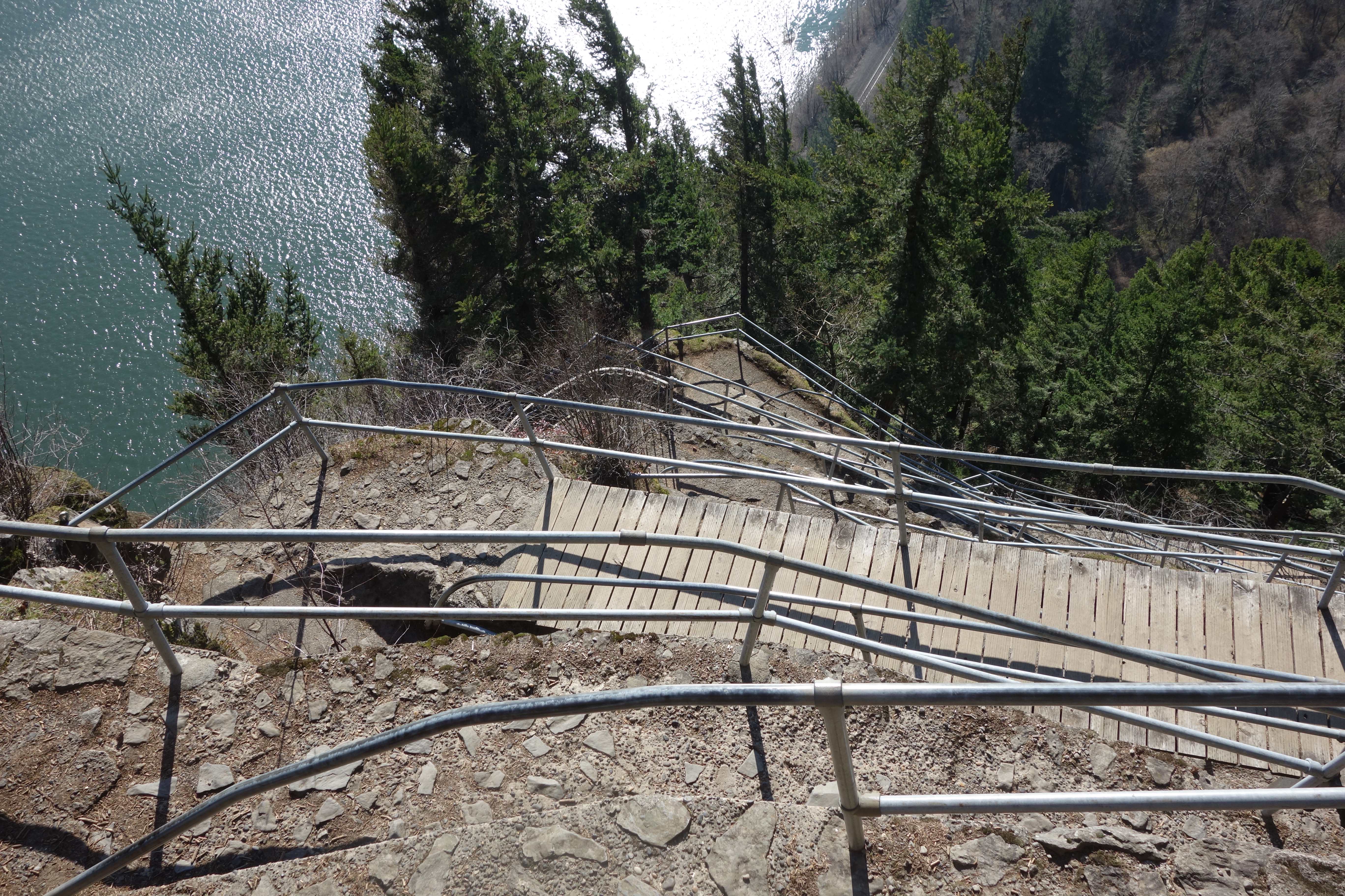
If you need a wilderness hike, this isn’t the place. It’s a busy spot out in the open. But if you’re looking for views of the incomparable Columbia Gorge, I don’t know where you’ll find better because sightlines are not obscured by the trees as they are on the paths further back from the river.
Because the hike is short and tends towards ‘easy’ you can add numbers to your fit-bit by travelling across the road and hiking around Little Beacon Rock, Hamilton Mountain, and Rodney Falls.